
This post may contain affiliate links. If you make a purchase through an affiliate link, I will earn a commission at no extra cost to you. Thanks for your support.
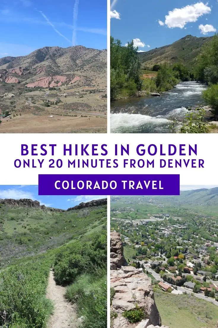
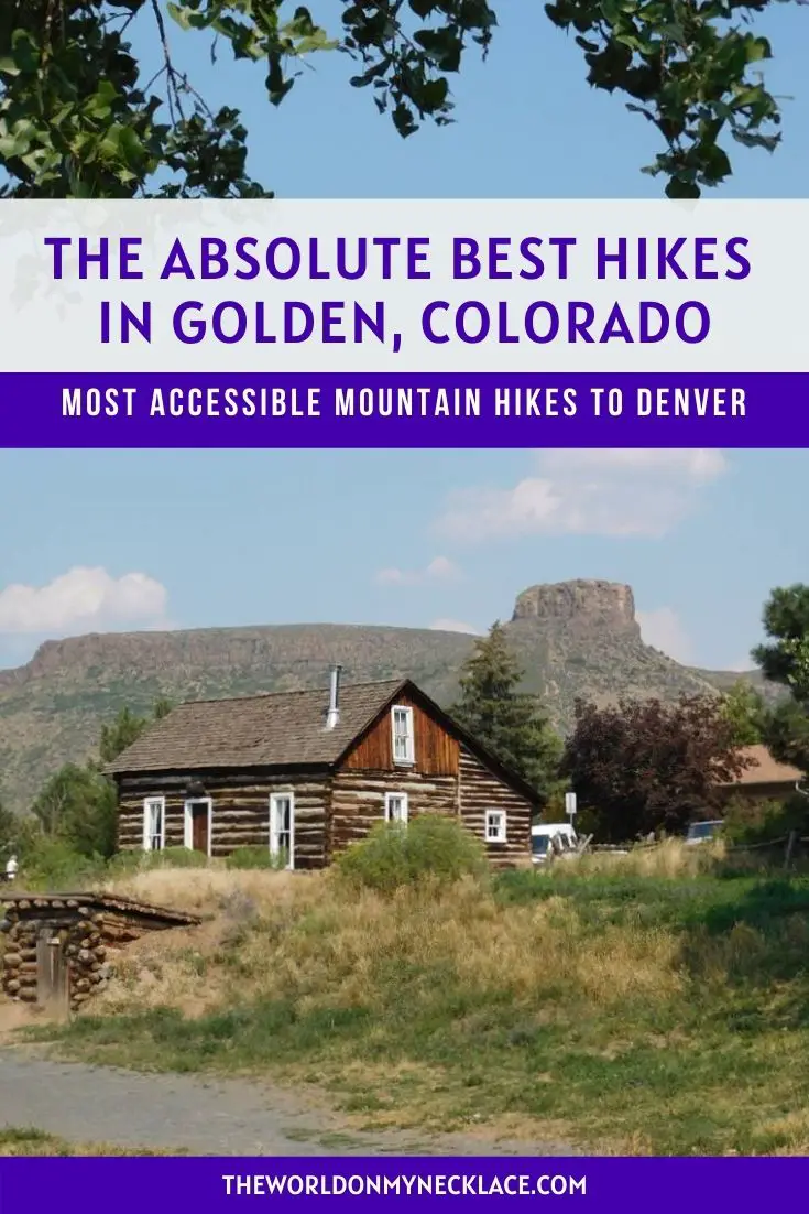
Want to find out the best hikes in Golden to work up a sweat and see some incredible scenery? I got you! Add these awesome Golden hikes to your Denver or Golden Itinerary.
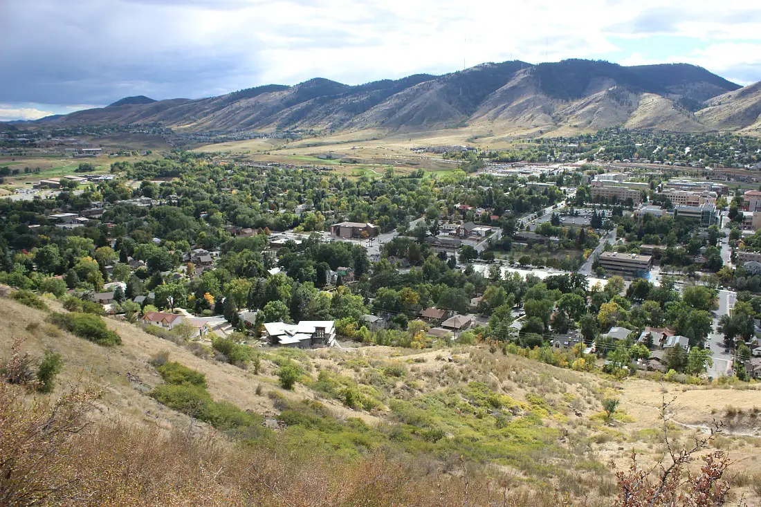
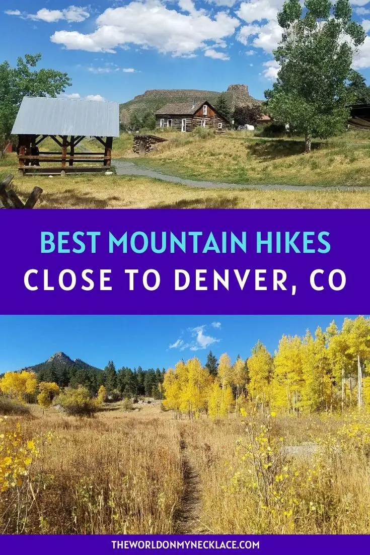
Golden, Colorado is a beautiful mountain town located at the base of the Rocky Mountain foothills in a river valley. It is literally surrounded by mountains and there are numerous state and mountain parks within a stone’s throw of town.

It is also one of the closest mountain towns to Denver so hiking in Golden is your best bet for getting into the mountains if you are visiting Denver and are short on time or don’t have a vehicle.
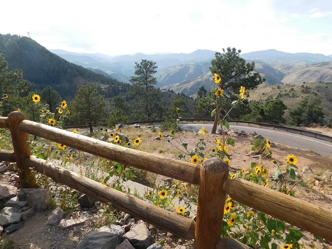
Another great thing about doing these Golden Hikes is that you can do them year-round, although late spring and early summer is the best time because everything is green and there are wildflowers everywhere, and fall is beautiful too, with the trees living up to the town’s name – a brilliant golden yellow.
So here are the best hikes in Golden if you are looking for a bit of a workout and to see some of the best mountain scenery close to Denver.
I have linked to the Alltrails directions and map where I could and I recommend downloading the Alltrails app so you can use it for the GPS to stay on track for these hikes.
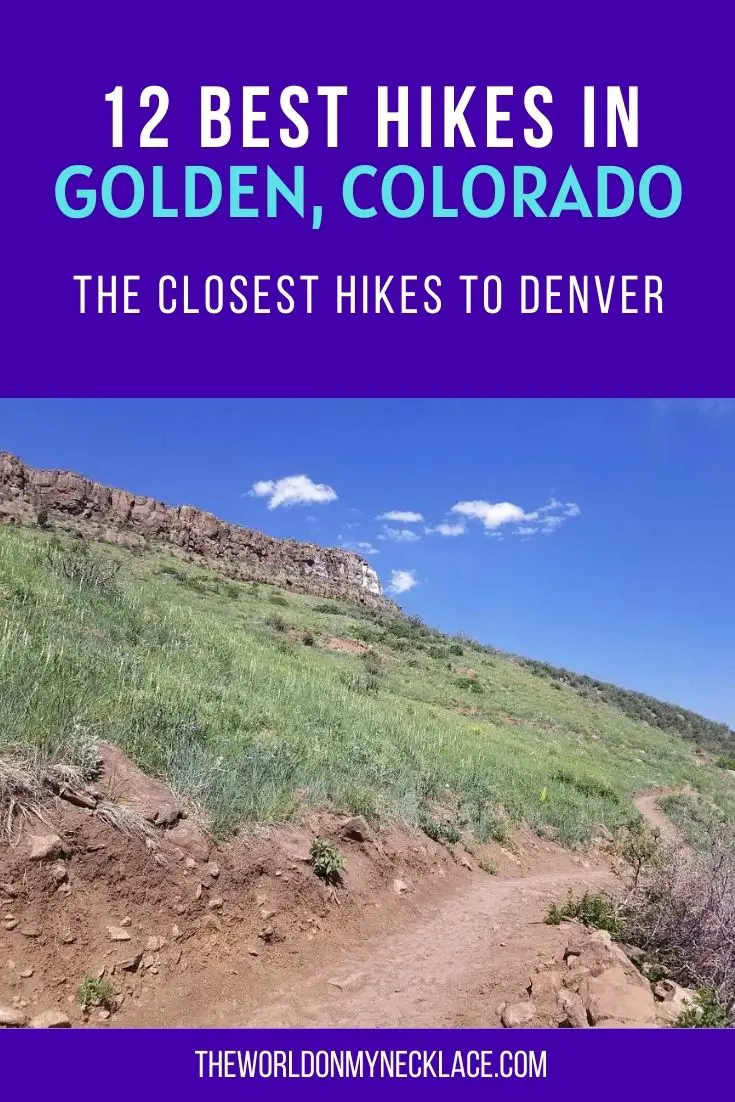
13 Best Golden Hikes
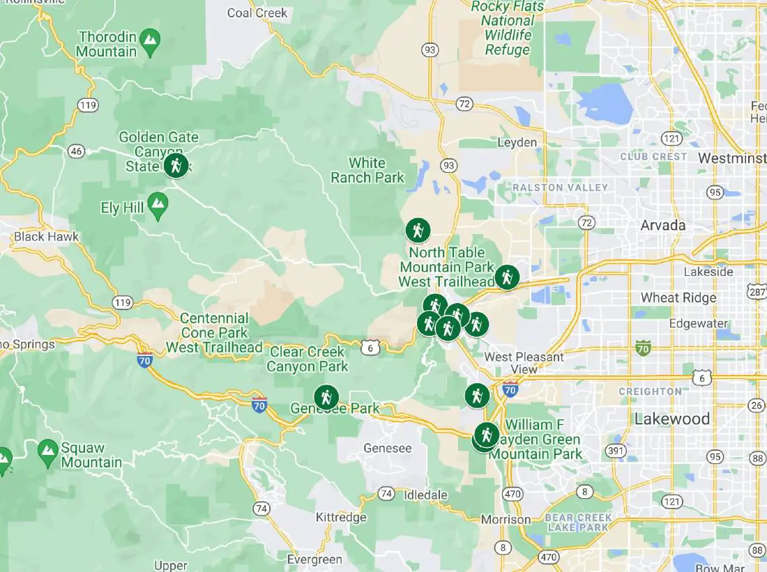
Check out my interactive map to see the best hikes in Golden.
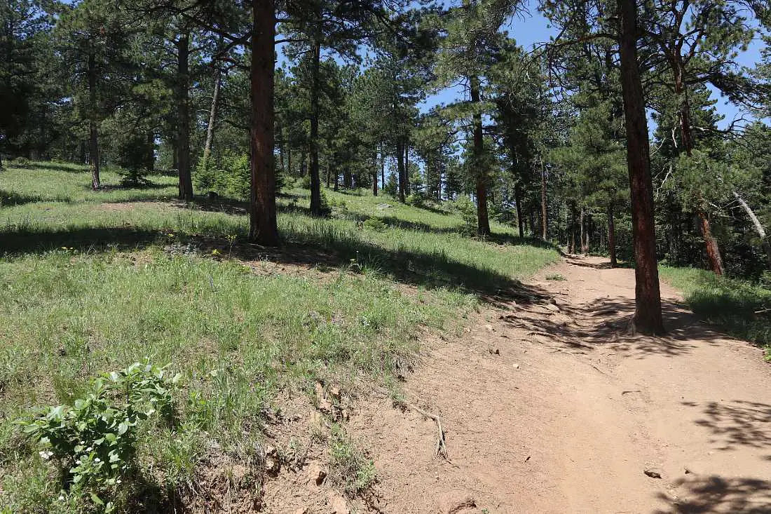
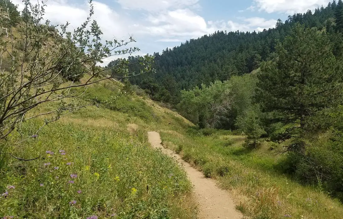
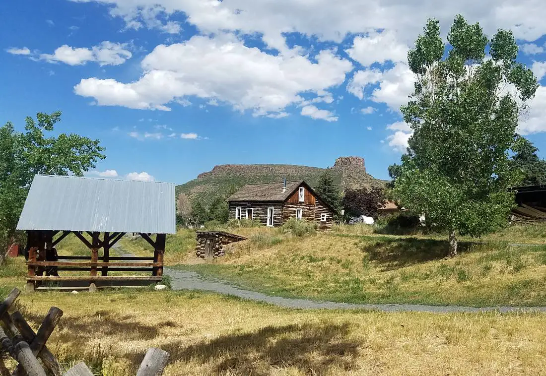
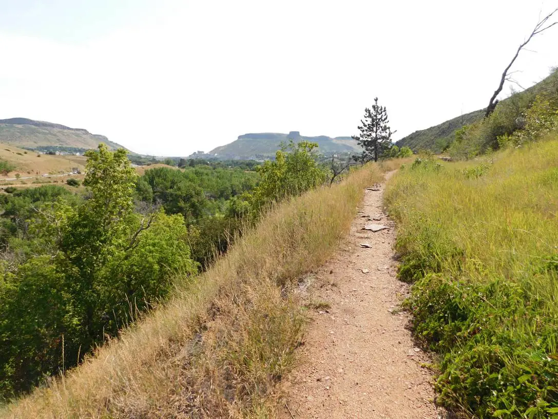
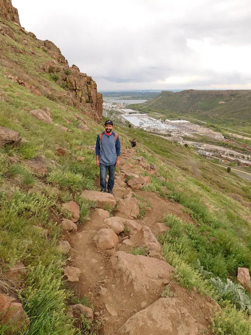
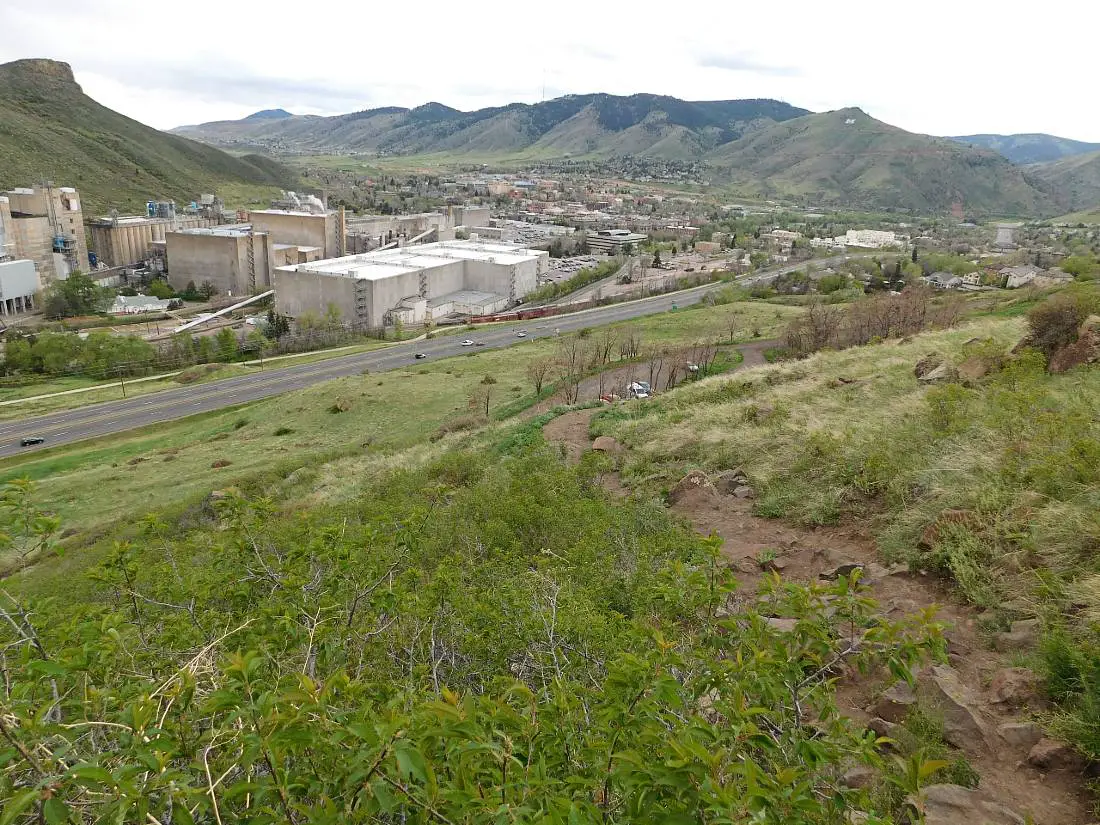
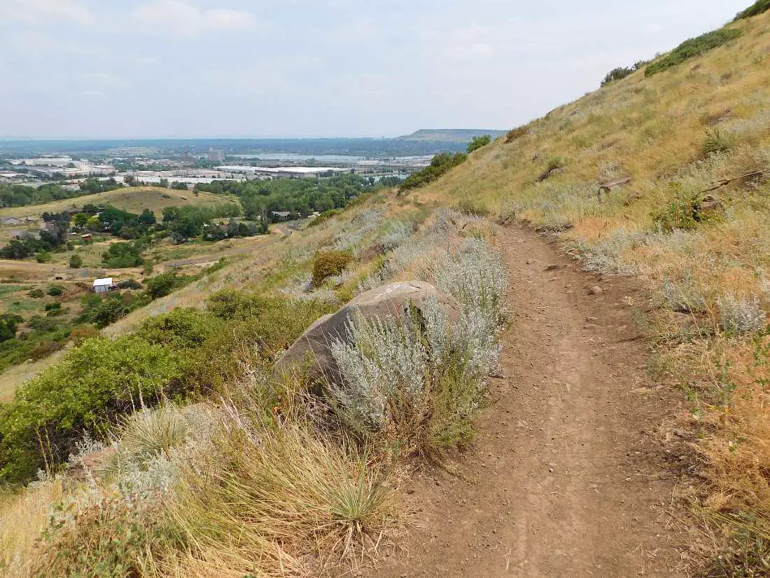
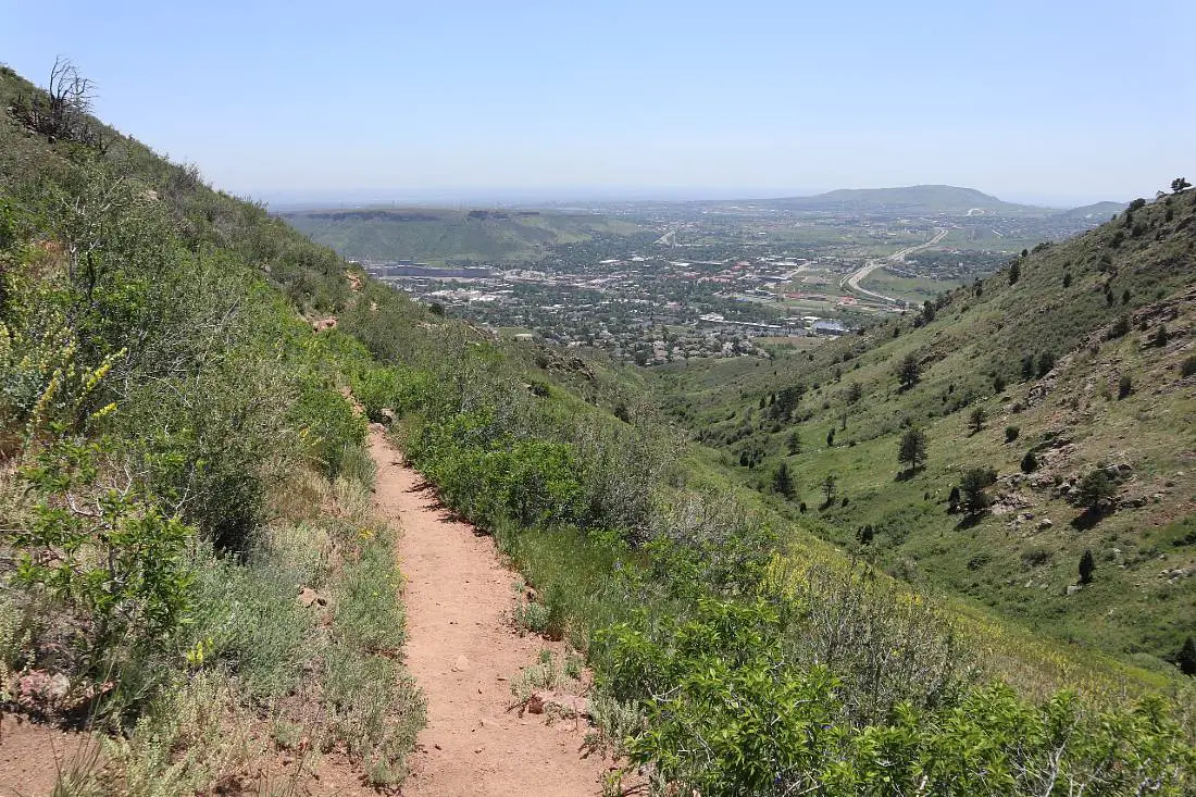
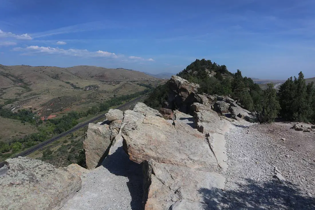
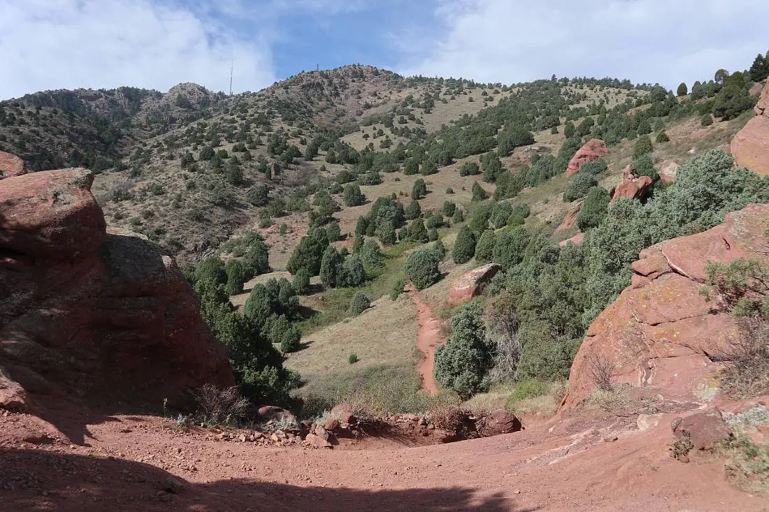
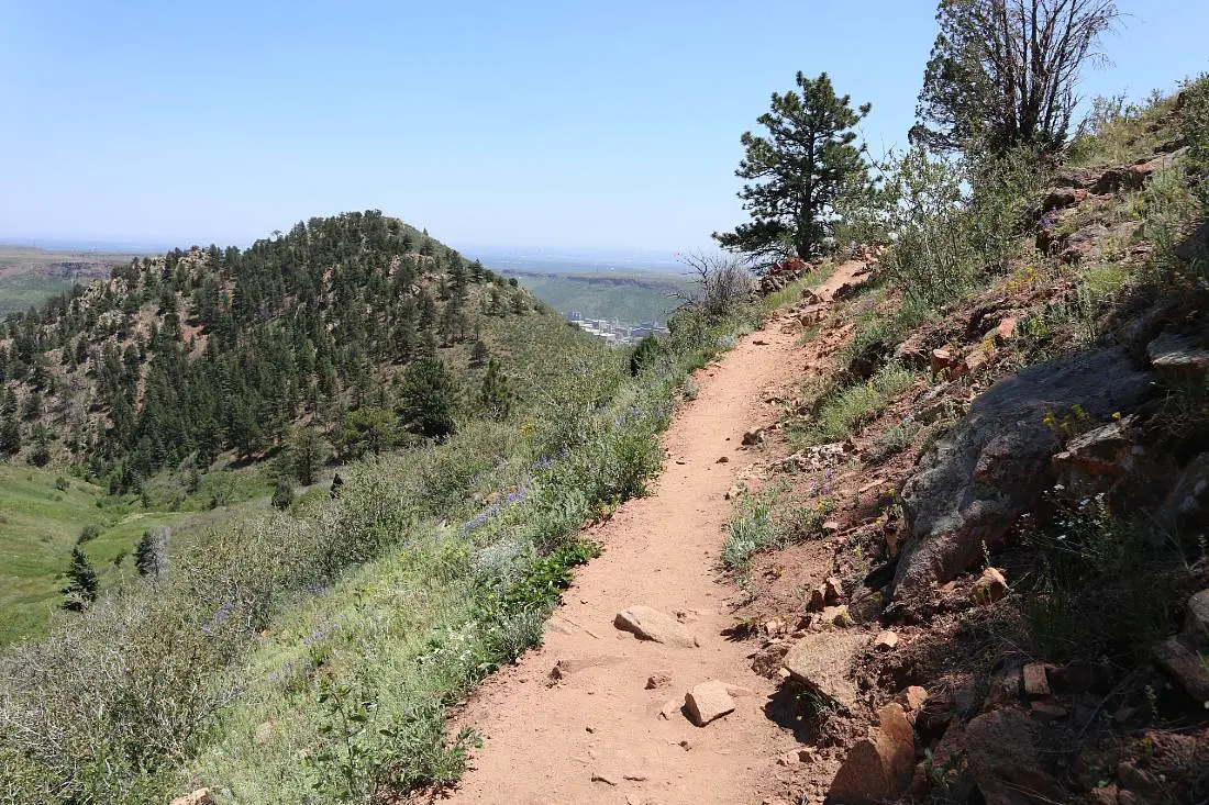
1. Chimney Gulch Trail
Distance: 6.5 miles out and back
Difficulty: Moderate
Elevation Gain: 1,755 feet
The Chimney Gulch Trail is one of the most well-known hikes in Golden, starting in town and finishing at on Lookout Mountain.
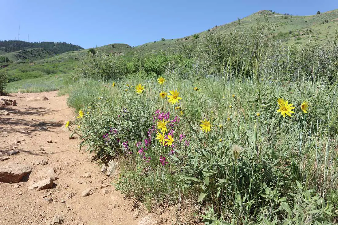
It definitely delivers in terms of mountain views, and in late spring and early summer, there are wildflowers everywhere.
The trail starts at Highway 6 or you can join it from the Clear Creek trail. It rises steadily for just over three miles, crossing Lookout Mountain Road twice, before finishing at the Lookout Mountain Nature Center and the historic Boettcher Mansion.
The first couple of miles offers no shade so start early if you are doing the hike in the hot summer months. In the last mile you will join the Lookout Mountain trail and this is through the forest which is a welcome relief from the sun.
There are numerous viewpoints along the way, firstly over Golden and across to Denver, then once you join the Lookout Mountain trail there are spectacular views in the other direction too, to larger mountains in the foothills.
Add another mile or so to the hike to visit Buffalo Bill’s grave and museum as well – definitely worth it if you have any interest in his life.
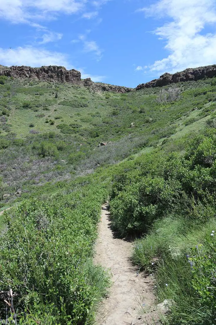
2. Apex and Enchanted Forest Loop
Distance: 5.5 miles loop
Difficulty: Moderate
Elevation Gain: 1,243 feet
Apex Park is located just west of Golden, and has loads of history – the Apex Trail itself follows the path of one of the old wagon routes that traveled to the goldfields of Central City during the Gold Rush.
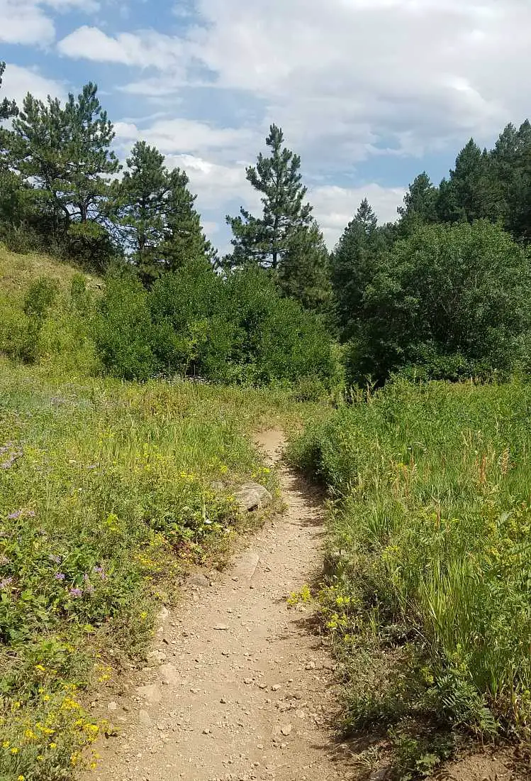
Start on the Apex Trail, a steady incline following the valley up and into the mountains. In spring and early summer, there are lots of wildflowers along the trail, and you will be following a creek on sections of the hike.
After following the trail for a little under two miles, you will see the turn-off to the Enchanted Forest trail. This part of the trail is in a shaded forest which is very welcome on a hot summer day.
It loops around and rejoins the Apex trail, and you will hike back down the way you came.
Make sure to do this hike in Golden on odd calendar days only, as it is mountain bikers only on some sections of the trail on even days.
It routinely closes in winter and early spring because of mud, so check online if it’s open if you want to hike during this time.
You can find a map and further details on Alltrails.
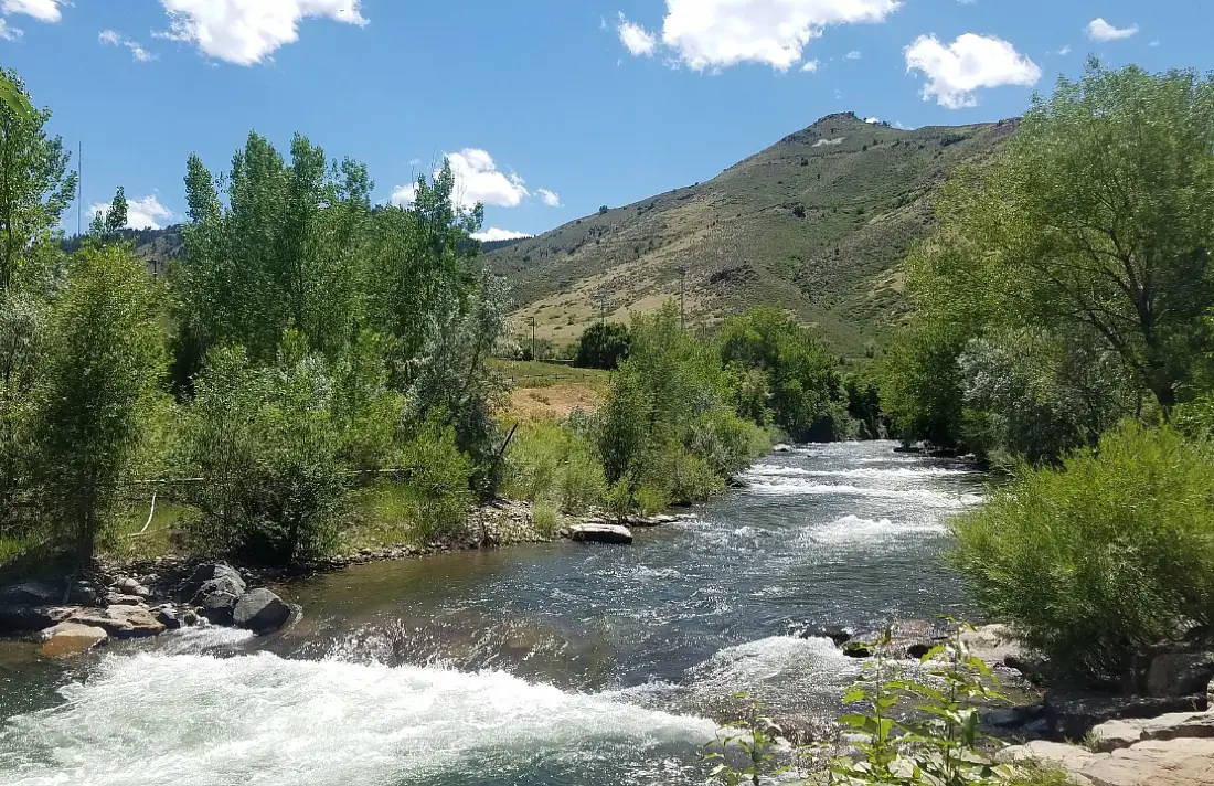
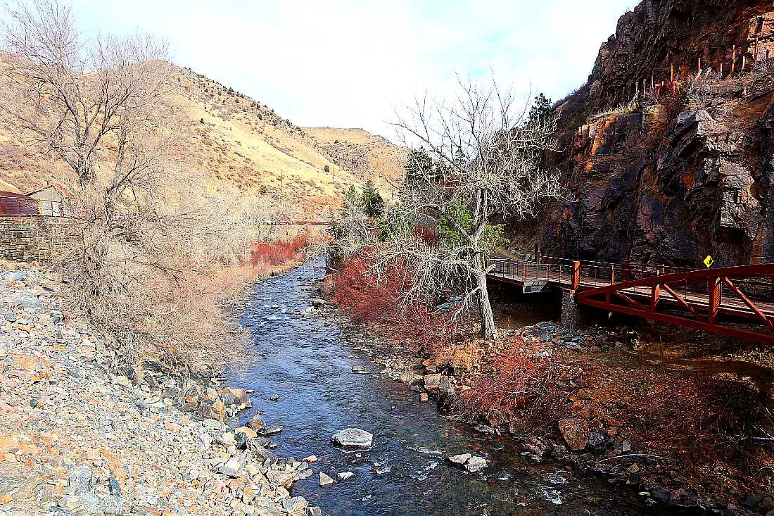
3. Clear Creek and Grant Terry Trail
Distance: 3 miles loop
Difficulty: Easy
Elevation Gain: 100 feet (approx.)
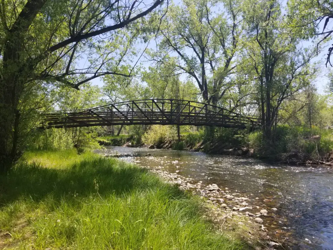
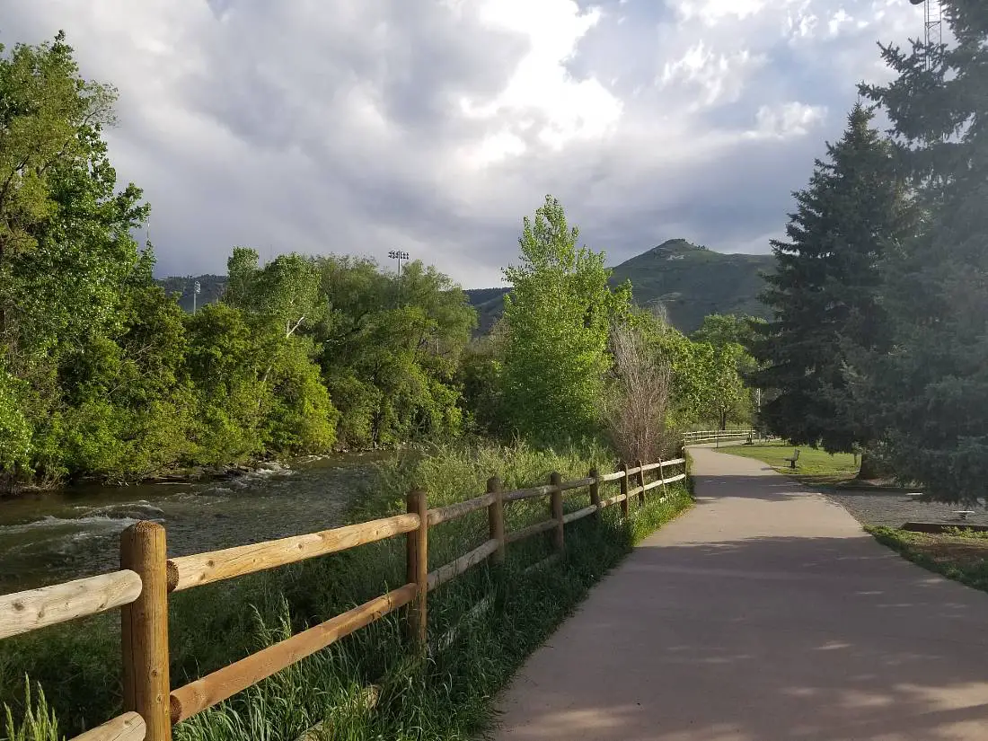
The most accessible and easy of these Golden hiking trails, the Clear Creek trail is perfect if you are looking for a scenic and gentle walk or bike ride. Add on the 0.7 mile unpaved Grant Terry trail to be even more immersed in nature.
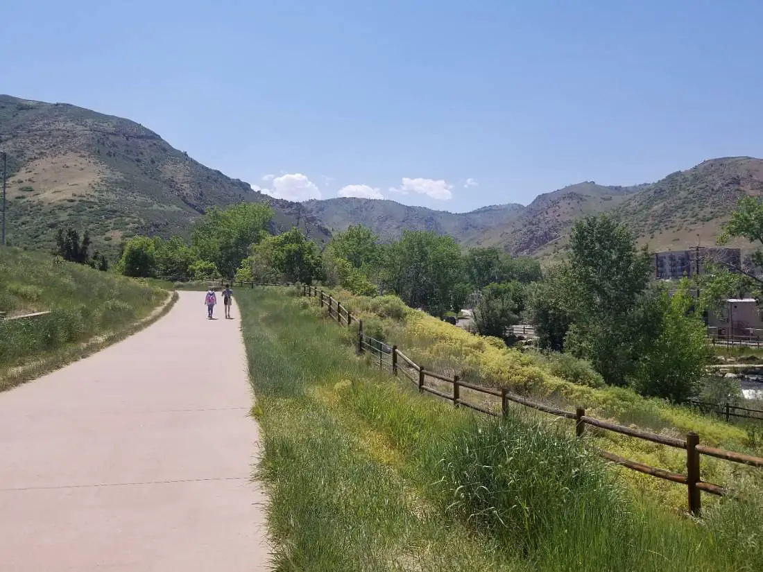
It follows lovely Clear Creek through the heart of Golden, where you can watch the tubers and white water kayakers in summer, and see some of the best fall colors in the Denver area in fall.
Although the full trail is 20 miles one way, you can do as little or as much of it as you want, and this section of the trail takes about an hour and covers the part of the trail that runs through Golden.
Start at the Visitor Center on Washington Street and head west. Once the trail turns to gravel (this is the Grant Terry trail), keep hiking until you get to a dead end. Take the path parallel along an irrigation ditch on the way back until you reach the bridge and rejoin the Clear Creek Trail.
Cross the river at the first bridge you’ll reach after the path is paved again, and continue walking east on the other side of the river until you can see the Coors Brewery at the Ford Street bridge.
Turn around and walk back to the Visitor Center where you started.
4. Canal Zone Trail
Distance: 1.3 miles
Difficulty: Easy
Elevation Gain: 206 feet
I love how quiet the Canal Zone Trail is – I hardly ever see anyone else on it and it is an easy but pretty hike in Golden that is accessible from the Clear Creek Trail.
Pick up the trail from the Clear Creek Trail, by crossing the bridge at Grant Terry Park.
Once you cross the bridge, you will hike a short way up Lookout Mountain, then you’ll take a left and continue along the trail with the mountain on your right and the creek below you on your left.
The trail follows an old irrigation ditch and there are sections of the hike where you can hike on the narrow concrete wall of the old ditch – if you are scared of heights, drop down into the ditch itself and hike along there.
Take the spur trail down to Highway 6 where you can see cars parked for the Chimney Gulch Trail, and either cross the road or take the path under the bridge to rejoin the Clear Creek Trail.
Hike more of the Clear Creek Trail if you are looking for a longer hike.
5. Lubahn and Olivine Loop
Distance: 2 miles loop
Difficulty: Moderate
Elevation Gain: 480 feet
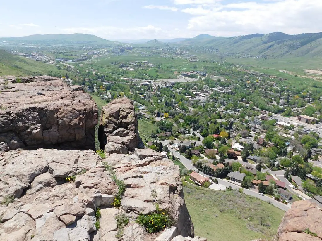
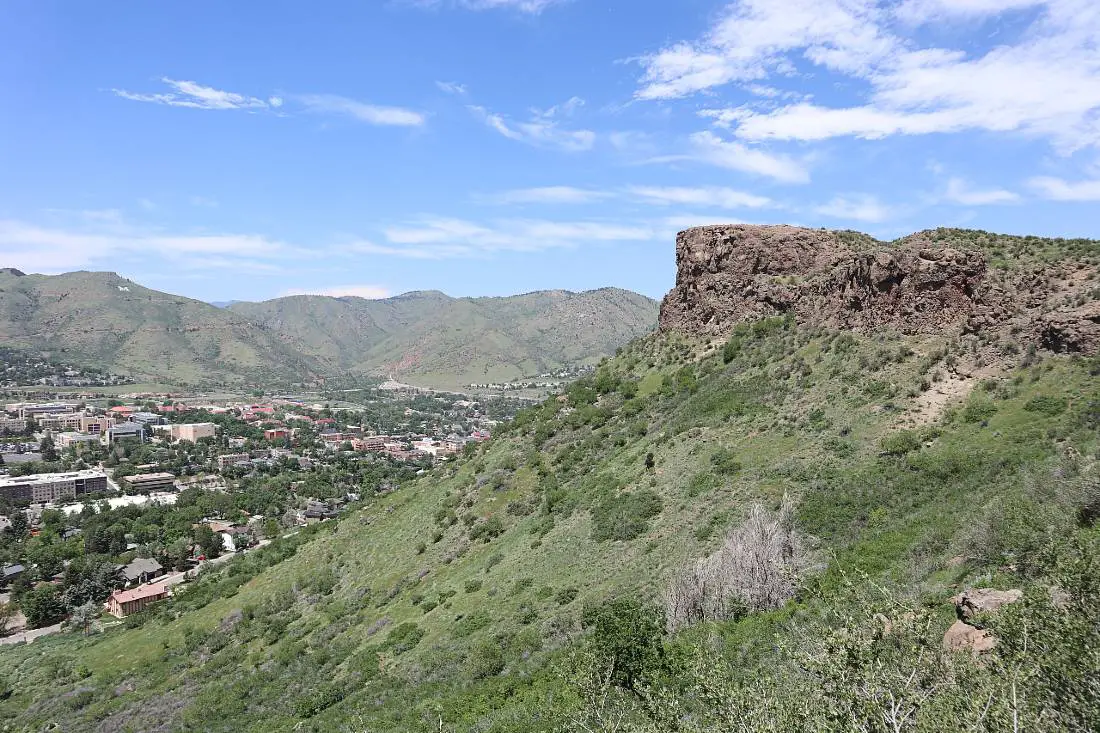
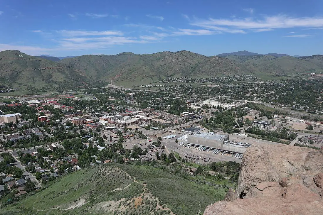
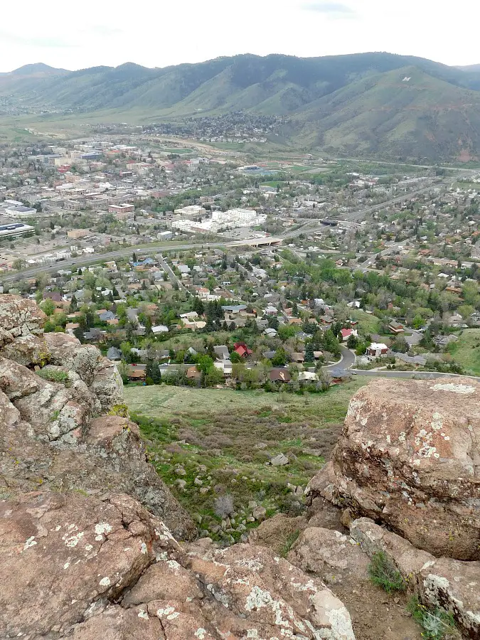
This hike in Golden in South Table Mountain Park is one of the hikes I do most frequently in Golden. It is one of the most accessible Golden hiking trails from downtown Golden and you can easily do this hike without needing a vehicle.
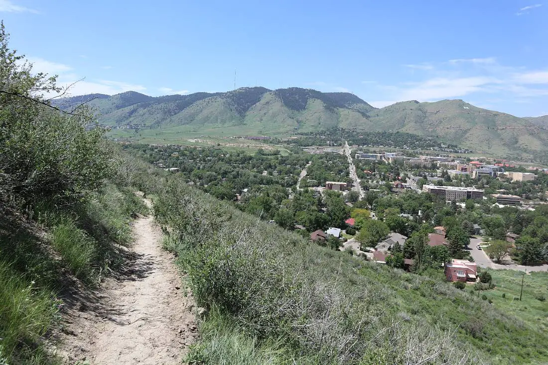
South Table Mountain is one of the two flattop mountains you can see on the eastern side of Golden.
There are a number of trails on the mesa top as well if you want to make this a longer hike – I recommend adding the Dome Flow Trail and Old Quarry Trail loop for an extra 2.5 miles of hiking.
Take the Olivine Trail up the mountain, it switchbacks upwards before going around the side of the mountain before popping out at the top.
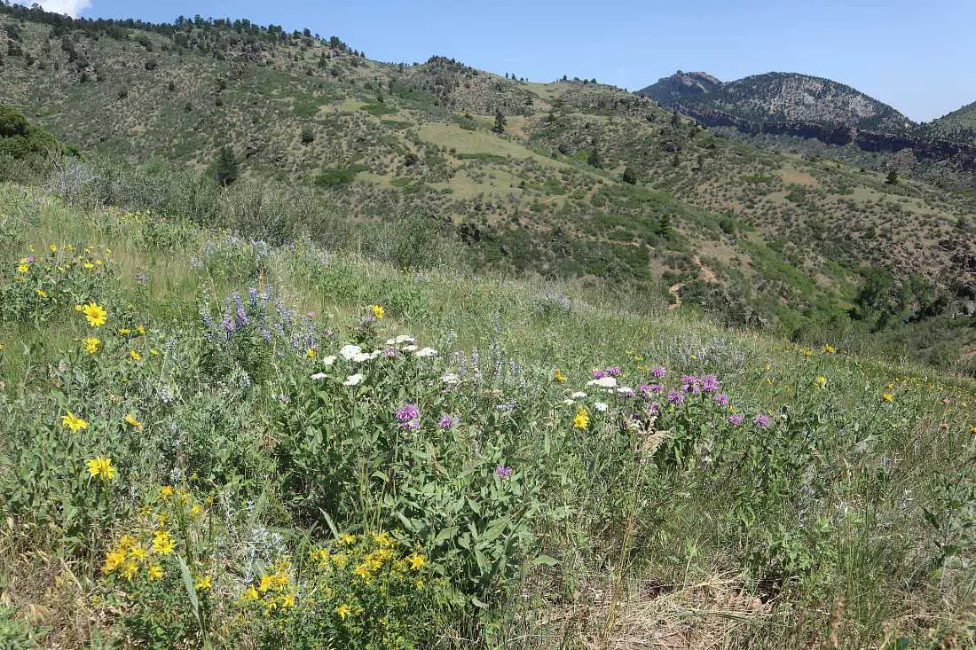
In spring and early summer, this trail is my favorite for wildflowers and you will see them mostly on the Olivine trail, and the views over Golden and the surrounding mountains are fantastic throughout the whole hike.
Once you get to the top, it gets a bit tricky. Technically Castle Rock, the rocky outcrop that juts out from the front face of South Mountain, is on private land so there isn’t an official trail to get there.
You can either follow one of the small spur trails you will see in front of you as you get to the top of the Olivine Trail, or you can turn right on the Old Quarry Trail until you see a larger trail on your left, this also leads to Castle Rock.
Admire the view over Golden and the larger mountains behind it from Castle Rock, then to get to the Lubahn trail, take the first trail on the right as you come down the stairs from Castle Rock.
Follow that around until you reach the Lubahn Trail – a steep trail down the mountain that isn’t recommended if you aren’t wearing decent shoes with grip or are scared of heights – you can hike back down the Olivine Trail if this is the case.
The Lubahn Trail switchbacks down the mountain with little benches to stop and rest along the way if your calves are burning. It will pop you out just up from the trailhead for the Olivine Trail.
On Alltrails this is called the Olivine trail loop.
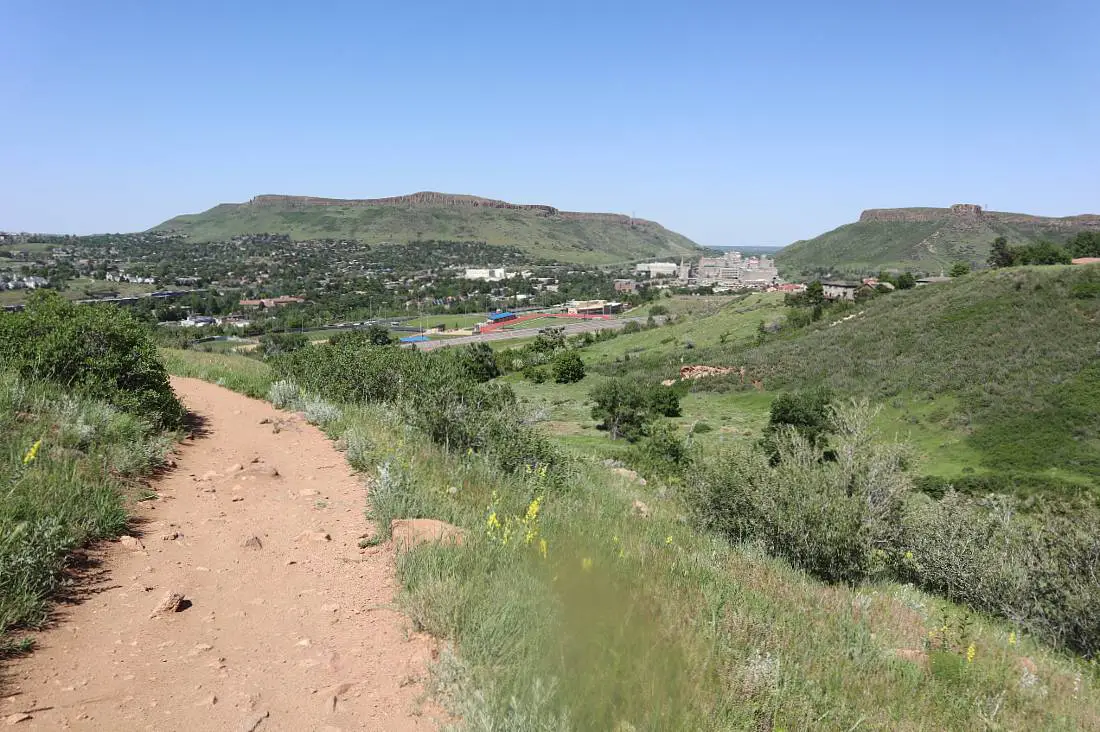
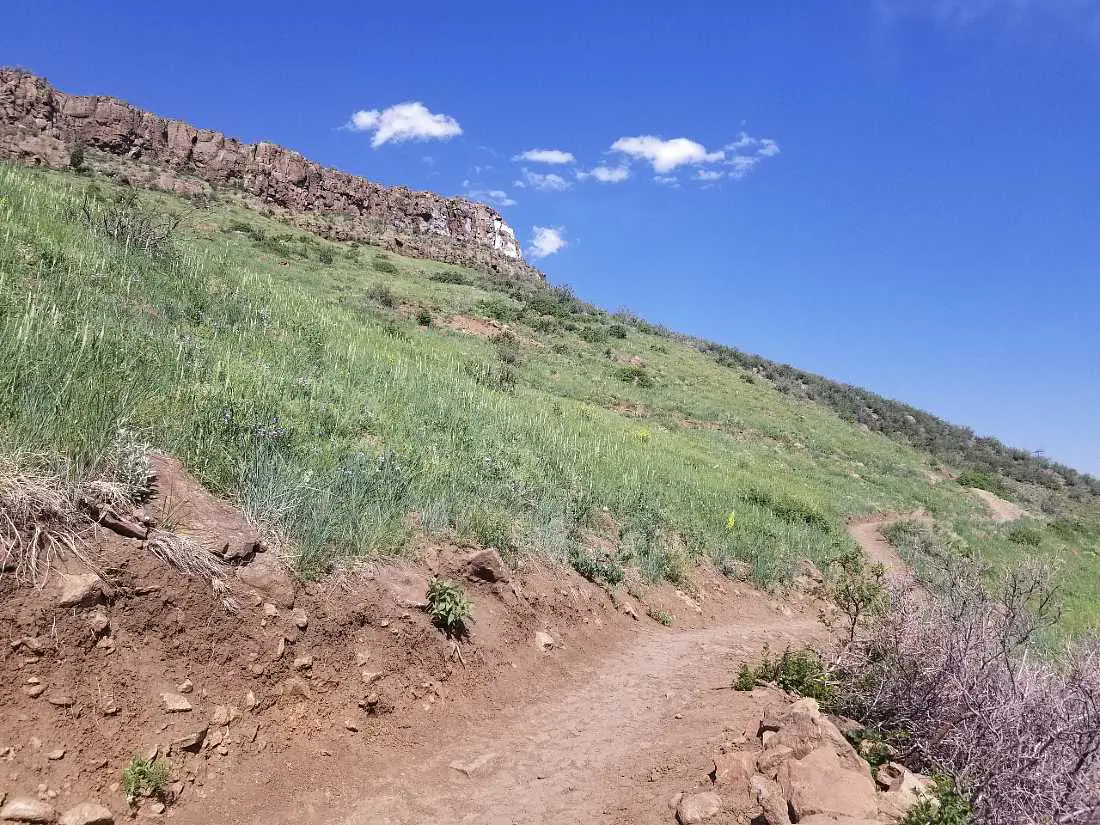
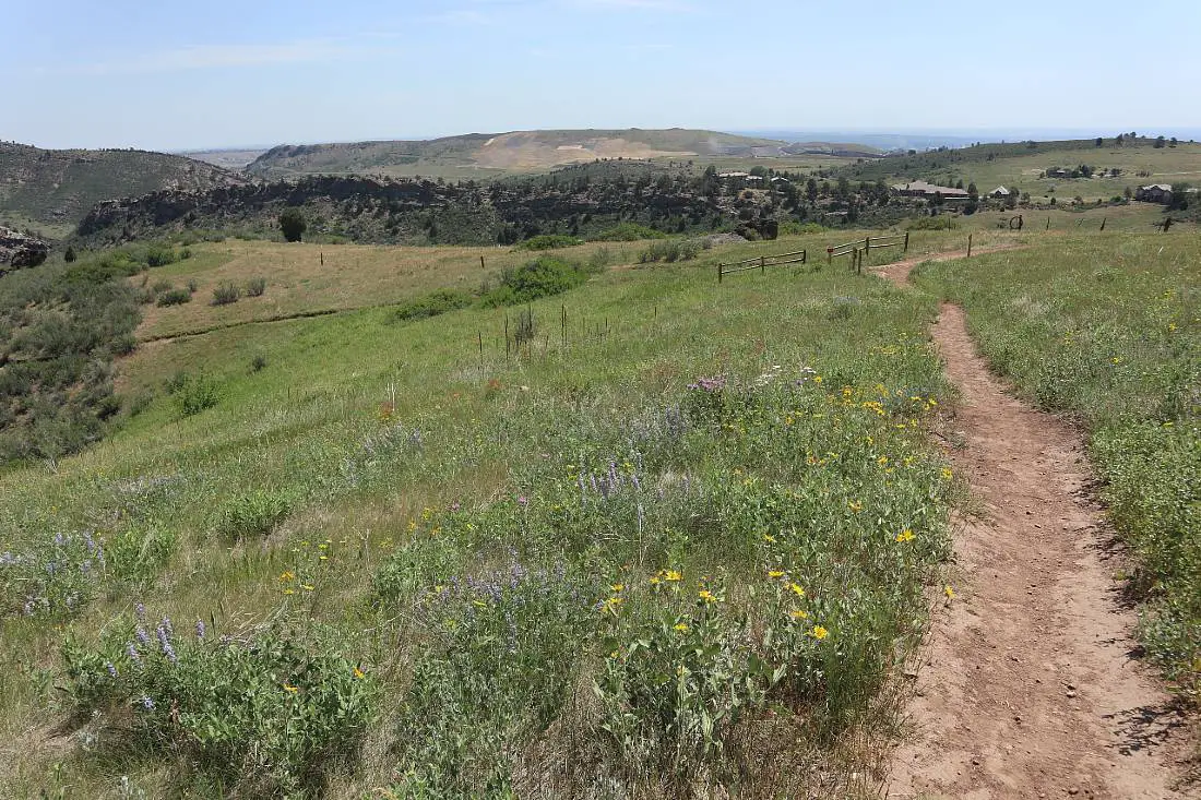
6. North Table Mountain and Rim Rock Loop
Distance: 8.3 miles
Difficulty: Moderate
Elevation Gain: 1,125 feet
This trail is in North Table Mountain Park, the other flat-topped mountain on the eastern side of Golden. It takes you around the mountain then up and around the mesa top. It is closed from February till July as raptor’s nest here.
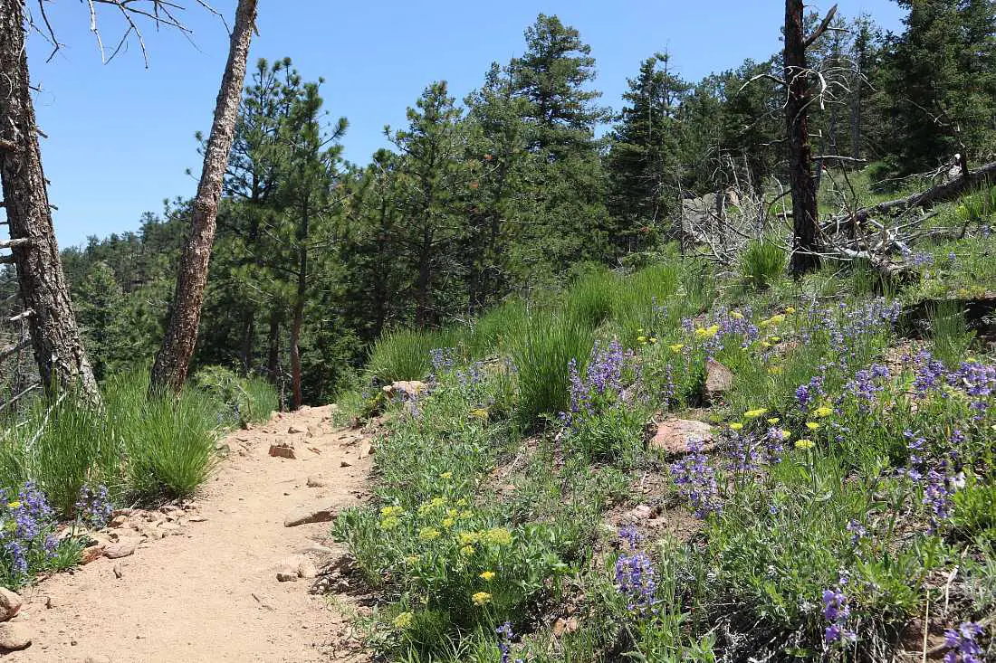
The whole trail has no shade, and there are lots of wildflowers in late spring and early summer – this is also when the mountain is at its greenest.
The first part of the trail you will be climbing up the mountain as you make your way around the eastern side. You will get views over to Denver in the distance, as well as Golden and South Table Mountain from the trail.
Once you reach the top of the mesa, you will continue hiking around the eastern edge, before looping around and dropping down as you hike the western rim of North Table Mountain.
In this section, you will get views over the larger mountains on the western side of Golden as well as over Golden itself. Then you will rejoin the trail you started on and will head back down the mountain to where you parked.
Celebrate completing the hike with a beer at New Terrain Brewery, only a short drive from the trailhead.
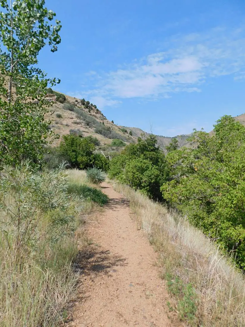
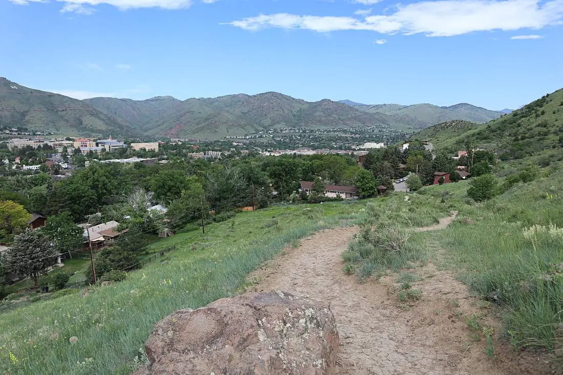
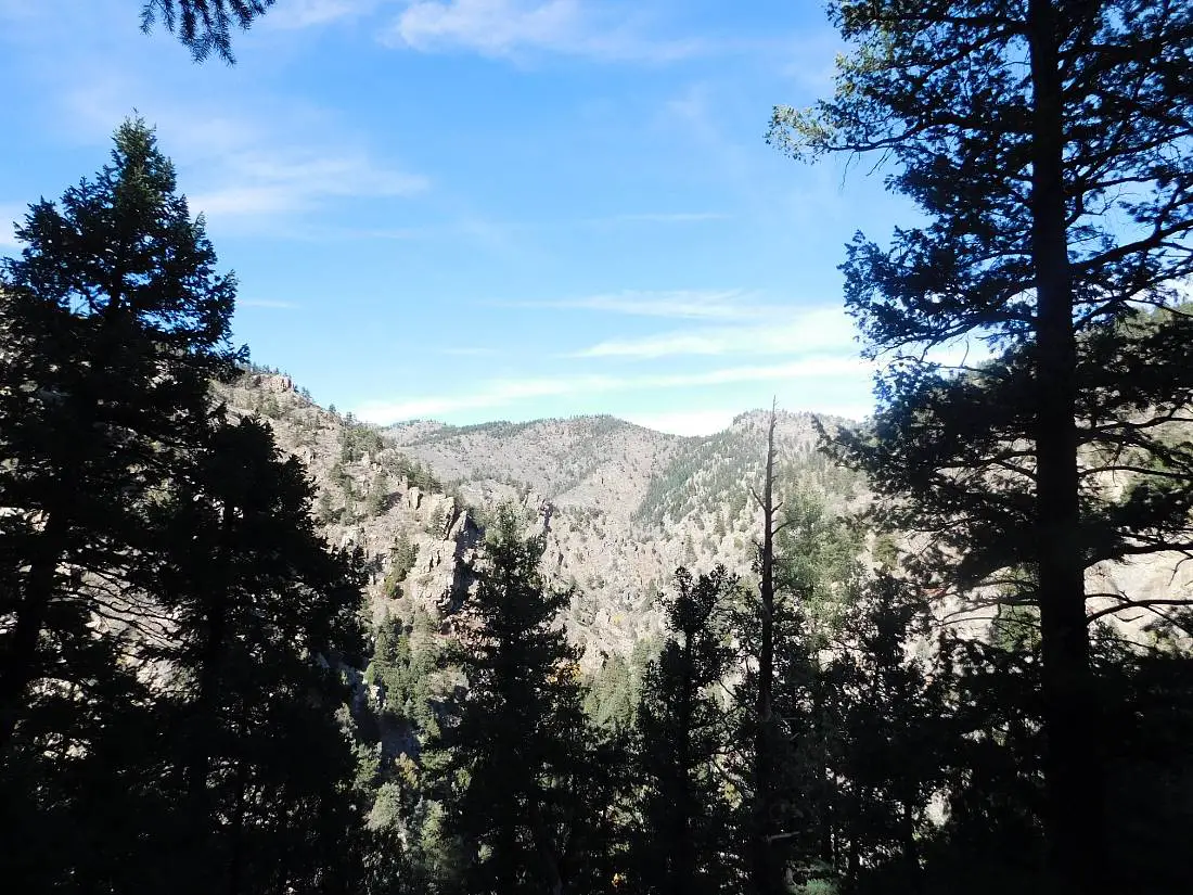
7. Mount Galbraith Loop Via Nightbird Gulch Trail
Distance: 5.5 miles
Difficulty: Moderate
Elevation Gain: 1,243 feet
There are two ways to get to the Mount Galbraith Loop trail in Mount Galbraith Park, and my favorite is via the Nightbird Gulch Trail.
This trail is another one that is very easily accessible from downtown Golden, and it starts from a suburban street. There isn’t much parking so try to get parking a few streets over or walk from Golden town center.
The trail rises steadily from the very beginning, up and then around the side of the mountain. It is a narrow and rocky trail with lots of wildflowers in spring and summer. There are great views over North and South Table Mountains and across the plains to Denver.
You will be hiking deeper into the mountains where you will meet up with the Mount Galbraith Loop. Around half of the loop trail is shaded and in pine forest and you will have great views over Lookout Mountain and further into the front range.
Once you have completed the loop, head back down the Nightbird Gulch Trail.
The other trail that connects with the Mount Galbraith Loop is the Cedar Gulch Trail. This is shorter at four miles and you will need a car to get to the trailhead.
8. Dakota Ridge
Distance: 5.4 miles
Difficulty: Moderate
Elevation Gain: 1,099 feet
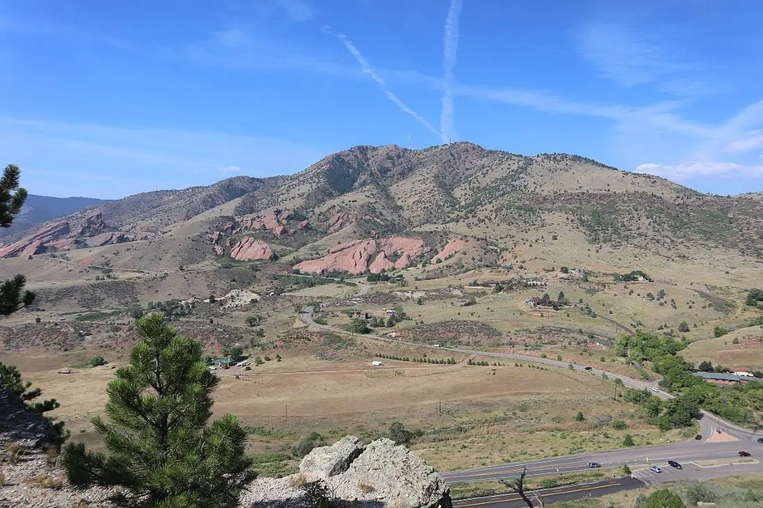
The Dakota Ridge Trail has one of the best views over Red Rocks as you follow a ridgeline parallel to it in Matthew Winters Open Space Park.
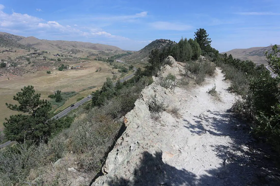
This hike starts with a climb to the top of Dakota Ridge, then it is full of ups and downs as you follow the rocky ridgeline south. There are scrubby pine trees along the ridgeline and some wildflowers in spring.
As well as looking over Red Rocks and the mountains of the front range to your right, you will be able to see Denver on the other side of the ridge.
There is a section where the road bisects the trail so you need to descend down to the road, follow it for a bit, then rejoin the trail. Make sure to read signage as there is a section of Dakota Ridge that is for bikes only, and you will need to turn around at this point.
There is not much shade on this trail so it’s best in spring or fall, otherwise, start early in the summer months – I overheated on this trail and it wasn’t fun.
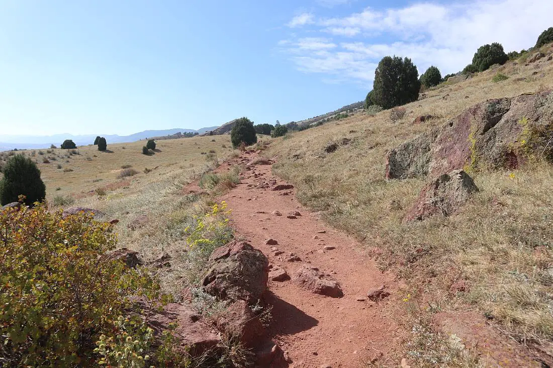
9. Village Walk, Red Rocks, and Morrison Slide Trail
Distance: 5.8 miles
Difficulty: Moderate
Elevation Gain: 1,181 feet
This is one of the longer trails in the area around Red Rocks Amphitheater, and will get you up close and personal to the awe-inspiring jutting red rocks.
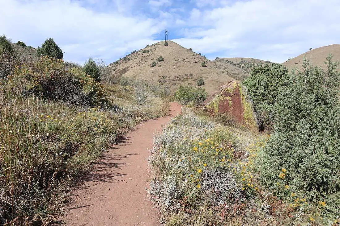
The trail is mostly in Matthew Winters Open Space Park and the first part of the trail will take you through rolling hills of grassland with red earth.
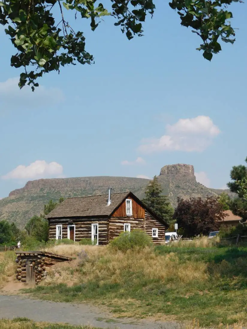
Right near the beginning, there is a small graveyard and information panel about Mount Vernon – a small town on an old wagon road that has vanished except for the small cemetery and a couple of stone houses nearby.
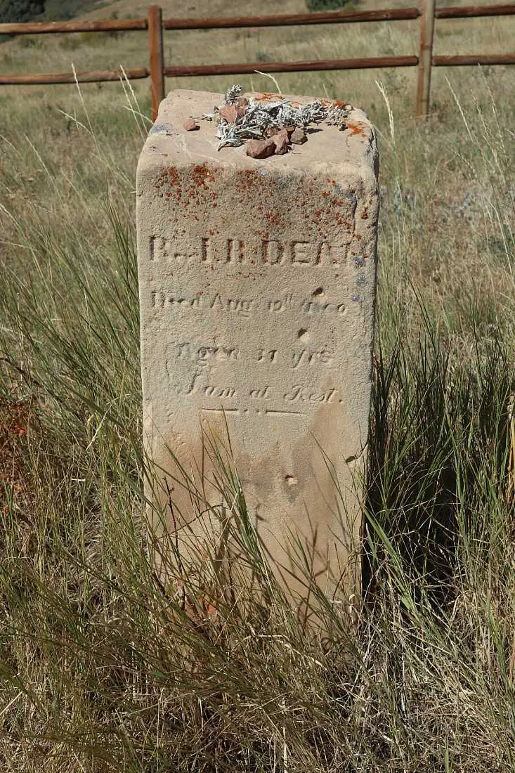
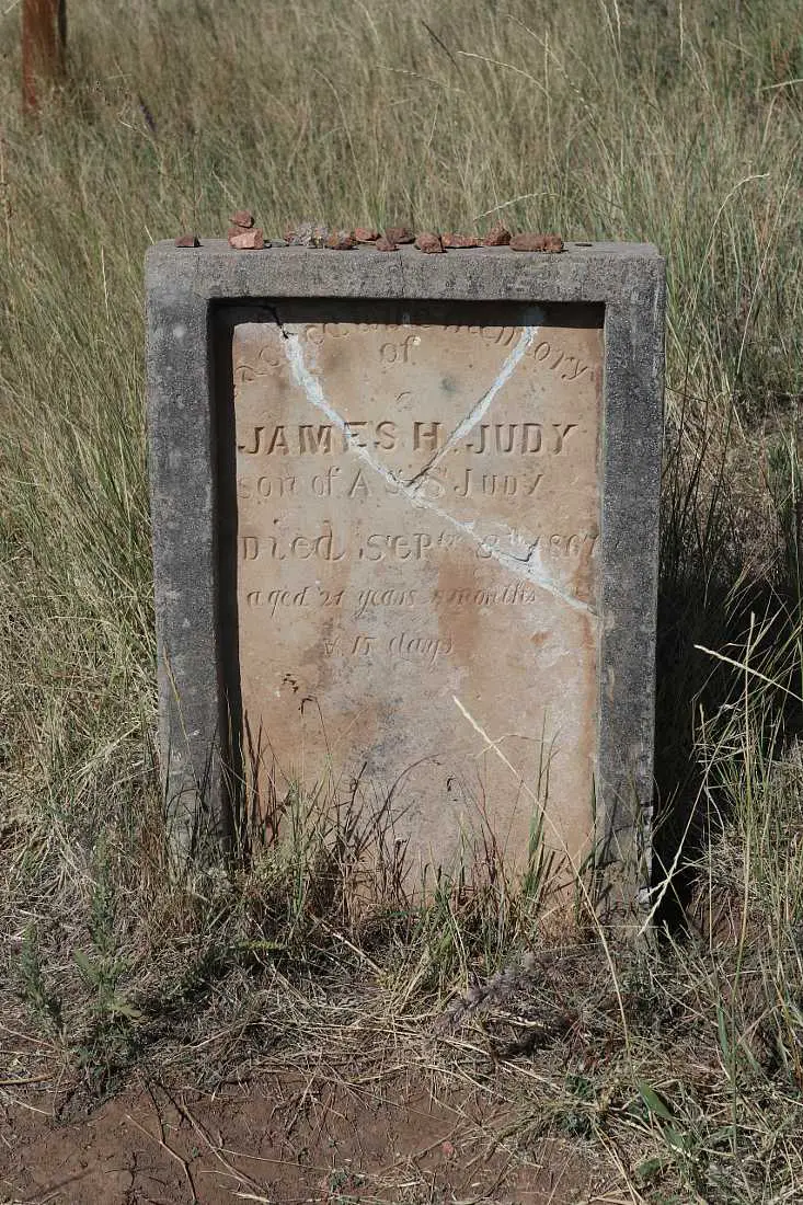
The best part of the trail is the second part, where you will be weaving around the magical red rocks through rich red sand. It’s incredible to see these rock formations towering above you.
If you haven’t visited the amphitheater, add that on to the hike, or drive there afterward to check it out as well as the Colorado Music Hall of Fame and the historic Red Rocks Trading Post.
There are a number of shorter trails around Red Rocks too if you don’t have the time or energy to do this longer trail. The Red Rocks Trading Post Trail is the best shorter hike at 1.5 miles and has some of the best scenery.
10. Belcher Hill, Longhorn, and Whippletree Loop Trail
Distance: 4.6 miles
Difficulty: Moderate
Elevation Gain: 938 feet
This loop trail will give you a great overview of White Ranch Park, to the north of downtown Golden.
There are fantastic views over the plains, and North and South Table Mountains from this hike, as well as beautiful wildflowers in season. There is some steady climbing and the trail is rocky in parts but there is nothing too difficult.
You will start on the Belcher Trail which descends slightly to follow a small stream. After crossing the stream, the path then climbs steadily to the junction with the Whippletree Trail after about a mile.
Turn right on the Whippletree Trail until you reach the junction with the Longhorn Trail. By this point, you will get some shade with stands of ponderosa pines and juniper trees to hike through.
The trail continues through forest and grasslands for another mile or so, and it will then turn into the Belcher Hill trail, looping back around to the point where it connects with the Whippletree trail. Take this trail back to the trailhead.
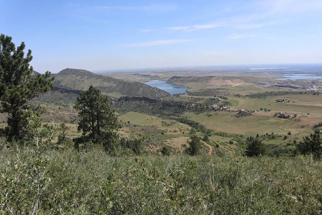
11. Black Bear and Horseshoe Loop
Distance: 6 miles
Difficulty: Moderate
Elevation Gain: 1,433 feet
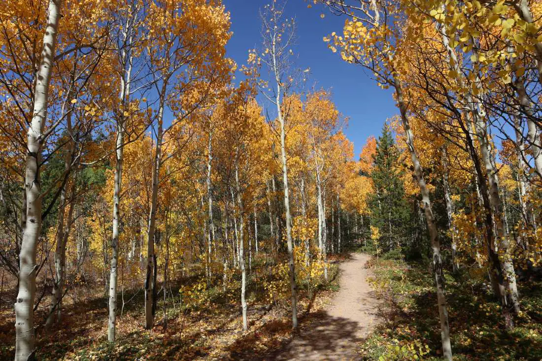
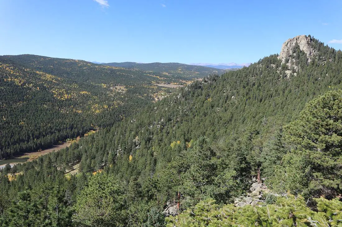
The Black Bear and Horseshoe Loop in Golden Gate Canyon State Park is one of my favorite fall hikes in Golden – it is absolutely spectacular in September when thousands of aspens turn gold along the trail and in the surrounding mountains.
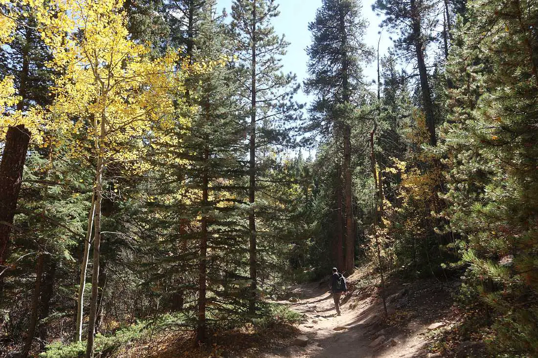
Golden Gate Canyon State Park is a 25-minute drive from Golden through the beautiful Golden Gate Canyon.
There are a number of great trails in the park but I think the Black Bear and Horseshoe Loop is the best all-rounder, with fall colors in September and gorgeous views all year round.
The first part of the trail involves a steady climb on a rocky trail through a pine forest. As you get higher up, the views of the surrounding mountains will start opening up and there are various viewpoints you can stop to catch your breath.
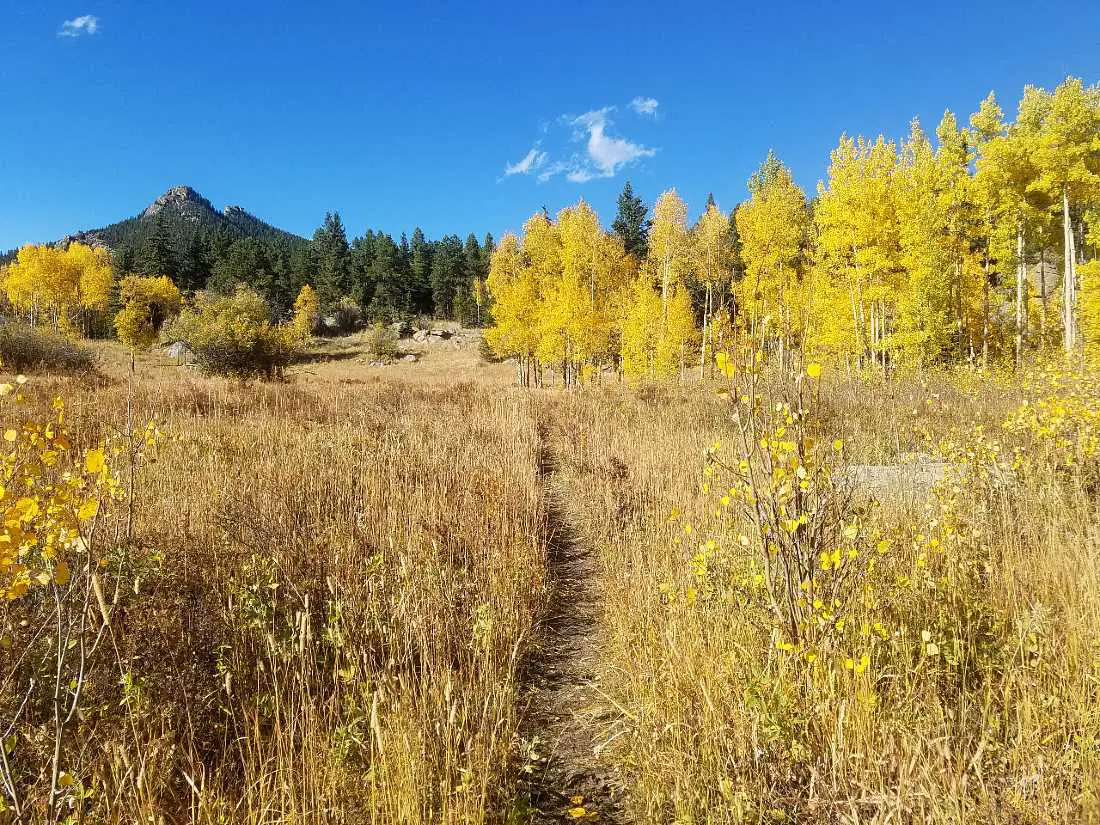
The Black Bear Trail does have some sections where there is some light bouldering but nothing technical. The trail starts back down the mountain and then connects with the Horseshoe Trail which heads north to Frazer Meadow.
Frazer Meadow has beautiful wildflowers in spring and golden aspens in fall, and there are ruins of an old cabin here. From there you will continue on the Horseshoe Trail as it loops back down to the trailhead.
There is a charge to enter Golden Gate Canyon State Park – it’s $10 and you will need cash. You can pay at the self-registration stand near the entrance if there is no one manning the booth.
Make sure to check out the Visitor Center while you are in the park too – there’s lots of great information about the wildlife and history of the area.
12. Chavez & Beaver Brook Trail
Distance: 5 miles
Difficulty: Difficult
Elevation Gain: 1,122 feet
The Chavez & Beaver Brook Loop trail starts near the Buffalo Herd overlook in Genessee Park, so make sure you go see the buffalo when you are in the area too.
This trail is one of the best hikes in Golden for a hot day because it is mostly through pine forest, and you will be walking alongside a creek for more than half of the loop.
There aren’t any grand mountain views, but there are a couple of places where you will be able to see the surrounding forested mountains, and in spring and summer there are wildflowers at points along the trail.
You’ll start the loop on the Beaver Brook trail as it rises steadily uphill. There are a number of creek crossings and you can even swim in some spots in the creek. In fall, there are fall colors you can see from the trail.
Once you get to the high point of the trail you will descend on the steeper and rockier Chavez Trail back to the trailhead.
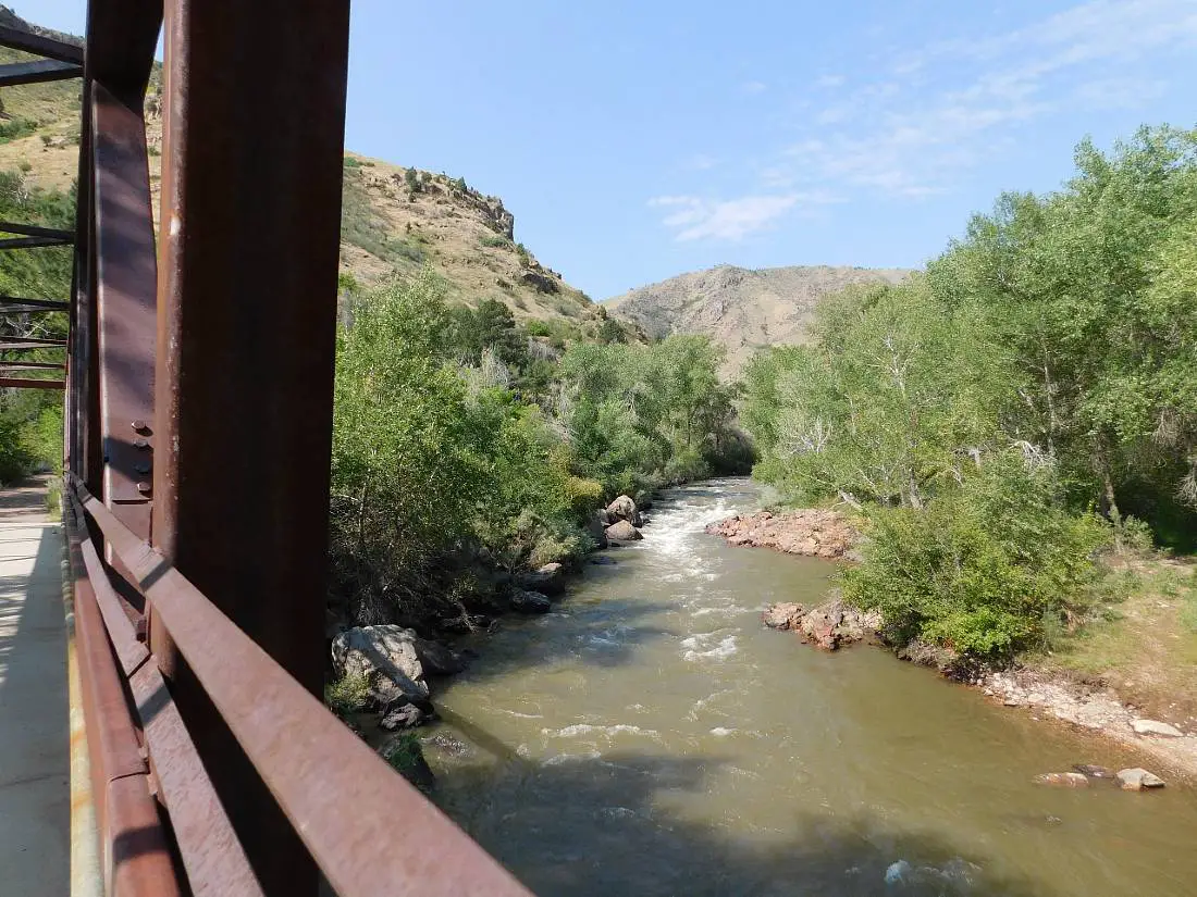
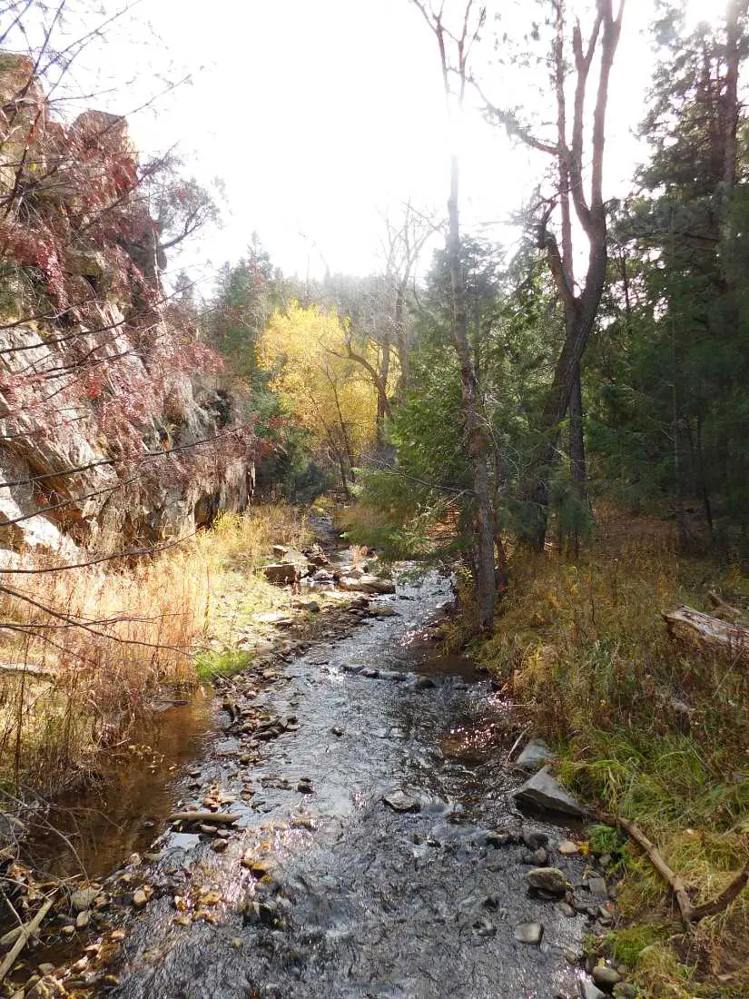
13. Peak to Plains and Welch Ditch Loop
Distance: 2.6 miles
Difficulty: Easy
Elevation Gain: 220 feet
Golden’s newest hiking and biking trail, the Peak to Plains trail is a great addition to the hikes in Golden. It is still being developed and it will eventually be a 65-mile trail into Clear Creek Canyon.
This section of the Peak to Plains trail – the Gateway Segment – was opened in August 2021 and follows Clear Creek further into Clear Creek Canyon than it was possible to walk before.
It is an easy and peaceful hike that is perfect for escaping the sun on hot days, and you will be accompanied by the soothing sounds of the creek the whole time.
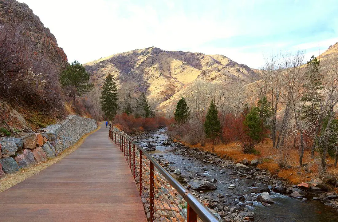
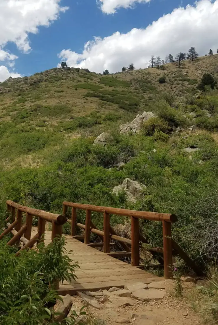
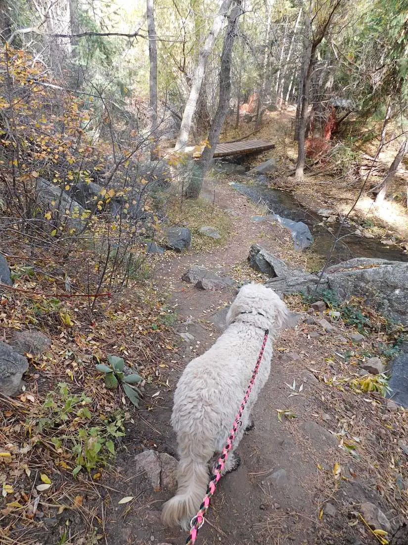
Starting from the Gateway trailhead or from the Clear Creek trail, cross the Grant Terry Bridge then follow the trail along the creek, crossing the bridge when you come to it, and continue along the other side of the river deeper into the canyon.
You will come to another smaller bridge and you will need to cross that too as the Peak to Plains trail finishes a little after the bridge. You are now joining the half-mile Welch Ditch trail that will take you on a hiking trail through a rebuilt historic wooden flume.
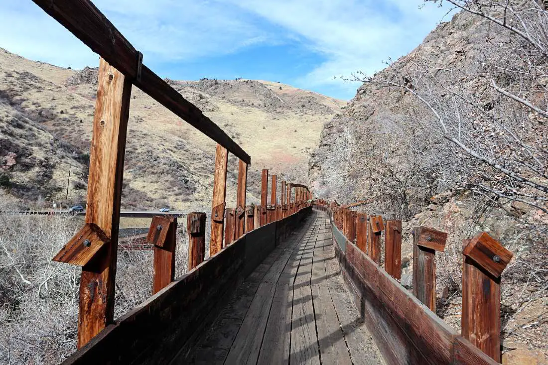
The Welch Ditch was originally built in the 1870s by Charles Welch and provided water to Golden City and parts of Jefferson County.
After a half-mile, the Welch Ditch ends and you can either take the stairs down to rejoin the Peak to Plains trail or continue on through the Canal Zone climbing area at your own risk (I don’t recommend this on the weekends when it is busy).
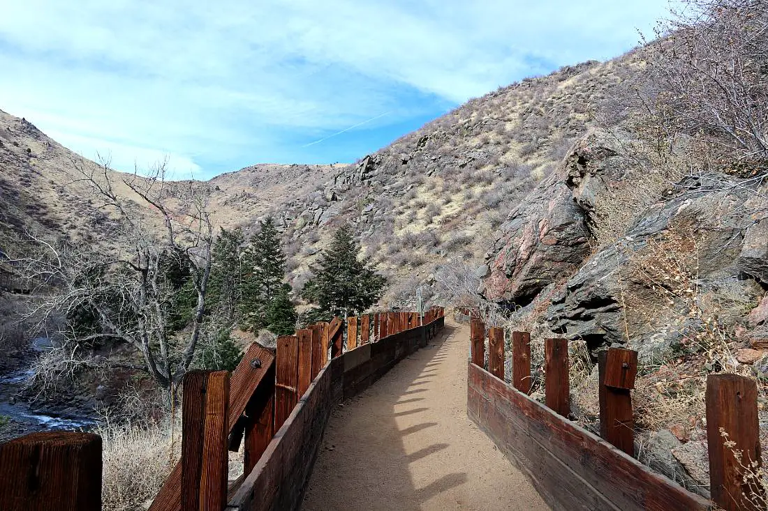
If you do continue, you will come to a point where the trail continues onto the Canal Zone trail on your right, or take the trail on the left, back down to the bridge over Clear Creek that you crossed at the beginning of your hike.
Planning Your Hikes in Golden
Tips For Golden Hikes
- It is common to see rattlesnakes on these trails, so be careful and give them lots of space if you see them on or beside the trail.
- It can get really hot in summer – like 90F-100F in the middle of the day – so take more water than you think you will need and start hiking early when it’s going to be a hot day.
- Some trails are closed in winter and early spring due to snow and mud – check online to make sure the trail you want to do is open before setting out.
- Be aware that lots of these trails are shared with mountain bikers so make sure to listen out for them and make room for them to pass.
- Follow normal hiking etiquette – give way to hikers going uphill and stay to the right of the trail.
- Thunderstorms are common in the mountains on summer afternoons so check the weather forecast and hike in the mornings if you can.
What To Take For These Golden Hiking Trails
Make sure you have the right hiking gear when tackling these Golden Hikes. For day hikes, the Cotopaxi Luzon is an awesome backpack choice as it is lightweight and will pack down easily when you’re not using it.
I definitely recommend wearing hiking boots rather than trainers for better grip as most of these Golden hikes are rocky with loose gravel.
As it gets hot in summer on these hikes, a CamelBak is an easy and lightweight way to bring lots of water and it’s easier to stay hydrated while you are hiking.
Take some trekking poles to help with the downhill on these Golden hikes – your knees will thank you!
Pack a rain jacket in case it rains – a common occurrence on summer afternoons, and if you are hiking when the weather is cooler, wear a lightweight but cozy thermal base layer top.
Where To Stay in Golden
Golden has lots of great hotels to choose from, stay at the adobe-style boutique Table Mountain Inn right in downtown Golden, the newly-built The Eddy Taproom and Hotel which has mountain views and is perched on a hill above town, or The Golden Hotel on the river right in town. The Silk Pincushion is a centrally located Bed & Breakfast with an exceptional breakfast.
If vacation rentals are more your style, stay at one of these highly-rated and affordable options in the Golden area:
- Historic Carriage House Near Downtown
- Bright Private Downtown Studio
- Charming Guest Suite Close To Town
- One-Bedroom Apartment in Historic Home
- Cute One Bedroom Apartment in Downtown Golden
If you liked this – check out some of my other Colorado content:
- 15 Fun Things To Do in Golden CO That Won’t Break the Bank
- 14 Best Denver Suburbs To Visit and What to Do, Eat, and See There
- Ultimate Colorado Road Trip Itinerary To See the Best of the State
- Fun Things To Do in Buena Vista, CO: One of My Favorite Mountain Towns
- 11 Best Mountain Towns Near Denver (1 Hour or Less)
- 15 Best Colorado Mountain Towns to Visit Any Time
- 15 Best Colorado Hot Springs For True Hot Springs Enthusiasts
- 10 Best Hidden Gems in Colorado
- The Perfect 3 Days in Denver Itinerary
- Visit Telluride: The Best Mountain Town in Colorado
- Hike from Aspen to Crested Butte: The Best Hike in Colorado
- Experiencing Cannabis Culture in Denver with a Cannabis Tour
PIN IT!
Please be mindful when writing these articles that there are often locals wanting to keep the low-key trails low-key. I’ve lived here my entire life and have watch the population explode. It’s fine, I get it. I live in a beautiful state, people want to move here. But it’s a treat to find those trailheads that a bit less traveled. Let’s keep it that way.
Hi Lindsay, thanks for your comment but I didn’t think any of these trails were a secret? I live in Colorado too and there are a lot of secret spots that not many people know about that I don’t share on here. I think showing people who want to visit Golden and hike there a lot of different hiking options helps to take the congestion away from the most popular trails.
Hiking is a form of self care and we don’t have the right to tell others how to share information with others or how to exercise their self care and doing things they love to do in the nature. It’s interesting how we analyze ourselves to understand what we can control versus what we can’t control.